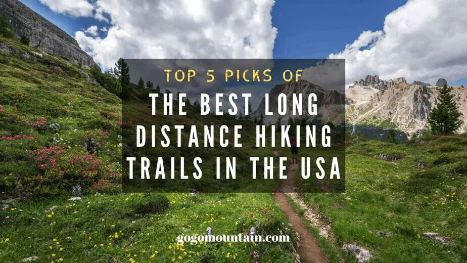
Top 5 Picks Of The Best Long Distance Hiking Trails in the USA
From eating healthy to enjoy the little pleasures in life, there’s something to be said about slowing down and prioritizing your health. While small, sensible changes can be helpful, sometimes you just need to disconnect for a few days, a few weeks, or even a few months. One of the best ways to unwind and unplug is to head out on a long distance hiking trip. There are thousands of miles of multi-use hiking trails spanning the United States – so many hiking trails, in fact, that it can be daunting to know which ones to choose from.
Fortunately, most long-distance trails and networks run close to each other and to major cities. There are likely at least a few that you’ve heard of, or maybe even head out onto for a short day hike. In addition, you won’t have to travel too far in order to find a long-distance hiking trail near you.
[toc]
If you know that you are fit or athletic enough to handle several days or weeks of movement, you should consider one of these trails. Not only will the serene, idyllic landscapes be enough to calm your mind, but you’ll also get in a great workout, too.
Here are my own personally chosen top five long distance hiking trails in the United States for you to consider.
1. Appalachian Trail
The Appalachian Trail is the big daddy when it comes to hiking, it’s on every serious hikers bucket to do list. The Appalachian Trail runs from Georgia to Maine, and is one of the most well-known and most frequently traveled long-distance trails in America. Viewed by many as the quintessential long-distance hiking experience, the Appalachian Trail begins at Springer Mountain in Georgia and sprawls all the way up to Mount Katahdin in Maine.
Each year, thousands of hikers begin at Springer Mountain in March and make the slog to Maine, where they hike until mid-October to Maine. However, you don’t have to be in it for the long haul to experience the insurmountable beauty of this trail – you can stop in at one of the various entry points to the trail so that you don’t have to spend six months hiking this 2,200 mile trek.
Location:
Maine to Georgia
Fees and Permits:
There are several parks along the Appalachian Trail that require entry fees, such as the Great Smoky Mountains National Park (though you’ll only pay about $20 per person for a hiking permit). Other parks, like Shenandoah National Park, are free, while some require backcountry permits if you plan on staying overnight. Make sure you look into the individual requirements of each.
Highlights:
There are almost too many highlights of this trail to mention, but some of the most noteworthy segments can be found in Shenandoah National Park. This park, located in the state of Virginia, is home to verdant forests and gorgeous mountain views. Plus, it’s only a short driving distance away from Washington, D.C., making it more convenient if you’re only interested in a short day or weekend hike. This specific section of trail spends about 100 miles in the park, giving you two options – you can hike the entire length and double back on yourself, or you can use the connecting trails adjacent to and inside the park to loop you back to where you started.
If you walk about six to eight miles per day, the average hiking pace on this terrain, it will take you about two weeks to hike one way and a month to start and end in the same location.
Another popular Appalachian Trail destination? The Presidential range in New Hampshire. This has some of the most unique terrain you’ll find, spanning over 10 miles of alpine tundra and 8 miles of rugged mountain terrain within the state’s famed White Mountains. The views are panoramic and constant, as the center of the Presidential Range consists of steep ridgeline with drop-offs on all sides. It takes about thirteen days to hike this trail one way.
Best Time to Go:
Navigating the Appalachian Trail can be tricky because it is so long and covers so many different geographic areas. Latitude and altitude play a major role in determining the best time to visit. In general, the southern portions of the trail are comfortable and safe to hike between the end of March and late November, but high elevations can occasionally be icy and cold in the early and late parts of the seasons.
The center portions of the hike, which include the Shenandoah trails we mentioned above, are best from the end of April until mid-October. You’ll have a chance to view some spectacular fall foliage but you’ll miss a bulk of the icy weather. If you’re hiking in the northern portions of the trail, you’ll want to stick to summer months only to avoid icy, muddy, or generally wet weather.
RELATED POSTS:
https://gogomountain.com/summer-camping-and-hiking-tips/
https://gogomountain.com/camp-for-free-in-usa-and-canada/
https://gogomountain.com/top-10-most-jaw-dropping-oahu-hiking-spots/
Directions:
The southernmost portions of the Appalachian Trail began roughly two hours northeast of Atlanta. The trail is within easy driving distance of many east coast cities, so you can hop on and off just about anywhere. If you don’t live close to the Shenandoah trail, you can take a flight to Washington-Dulles. Similarly, if you’re interested in hiking the White Mountains section, fly into Logan Airport in Boston. Both airports will get you about two to three hours from the destination. Most nonstop flights start at around $175 to $200, depending on where you will be flying from.
Once your plane lands, you’ll need to do some driving. If you’re hiking in the White Mountains, start at the trailhead that is marked by a crossing with NH-112, one of the area’s most scenic mountain routes. To get there, you’ll take 1-93 north to exit 32 and then drive northwest on NH-112.
If you’re headed to Shenandoah, you’ll want to get to Skyline Drive. This follows the trail for most of the park’s length and intersects a number of trailheads. If you’re starting from the south, park at the Turk Gap parking lot, which is about 12 miles north of I-64.
Other Information:
There are plenty of places for you to stay while hiking the Appalachian Trail. Campsites are usually between $5 and $30 per site, depending on the season and location. Some campsites in national parks can be up to $50, though, so plan accordingly. If you’re looking for something less rustic, there are huts and hotels along the trail, too – just be prepared to have your wallet ready. Some huts in the White Mountains, like the AMC White Mountain Huts, offer breakfast and dinner along with running water – but they charge over $100 per person during peak seasons.
Remember that cell phone service isn’t always guaranteed on this trail, although you will likely have it quite often, since the trail runs so close to many metropolitan areas.
2. Colorado Trail
Traversing 500 miles of Rocky Mountain terrain, the Colorado Trail runs from Denver to Durango. The trail has an average elevation of a whopping 10,000 feet and is home to several remote stretches, making it a bucket list hike for serious adventurers. But it’s not to be taken lightly – if you’re coming from a lower-elevation area, you’ll need a few days to acclimate to the elevation by spending a few days in Denver (and then a few active days at a moderate elevation of up to 8,000 feet) before you begin hiking.
Once you feel physically prepared, the Colorado Trail will be well worth your time. It offers exquisite vistas from its statuesque peaks, allowing you to look down upon countless streams, lakes, and flower-strewn alpine meadows. It does not submit any “14ers”, or peaks of 14,000 feet or more, but it does pass close by the 14,005-foot Mount of the Holy Cross. You can reach this in an aggressive day hike.
Location:
Colorado
Fees and Permits:
There are no fees or permit requirements to hike this trail. However, some wilderness areas will require you to check in (for free) at a registration station before beginning.
Highlights:
The Colorado Trail is broken down into 28 segments, many of which are easily accessible. Waterton Canyon is the easternmost point of the trail, and you can follow the first four or five portions to end at either Kenosha Pass or Long Gulch. This will take you about two weeks to complete, as you’ll cover up to 75 miles.
Best Time to Go:
This trail is covered in snow and mud until July some years, and winter weather can begin as early as early October. If you’re hoping for the best possible weather, plan a trip for August or September – but know that the climate can be unpredictable, particularly on the highest peaks. Sudden thunderstorms can be deadly if you’re above the treeline. You’ll want to begin a day hike before dawn and finish in the early afternoon to avoid this kind of nasty weather.
Unfortunately, portions of the Colorado Trail are open to equestrians and mountain bikers. It might be worth your time to schedule a visit during off-season times so you aren’t overrun during busy periods.
Directions:
Waterton Canyon is the most accessible portion of the Colorado Trail. You can reach it by flying or driving into Denver. The easiest flights are to Denver International Airport. From there, you can drive to within ten miles of the trailhead and walk the rest of the way.
Other Information:
Overnight use is restricted in all areas except Waterton Canyon – but you can pitch a tent on any public lands along the Colorado Trail as long as you are not closer than 100 feet to marked trailheads. Luckily, this is free. Cell service is good in Waterton Canyon as well as other portions of the trail. You may be able to call a cab from some portions of the trail, too.
3. Long Trail
Hailed as the oldest long distance trail in the country, the Long Trail follows the north-south ridge of the Green Mountains in Vermont. It starts at the Massachusetts border and ends at Canada, covering about 270 miles with an additional 175 miles of offshoot trails. You’ll be treated to panoramic displays of green valleys and rocky mountaintops from the many peaks, with minimal road crossings. It’s a true hiking trail, too, with no horses or bikes allowed.
Location:
Vermont
Fees and Permits:
None required
Highlights:
Most hikers can cover the Long Trail in fewer than 20 days. However, if you don’t have a full three weeks to commit to the trail, you can hop on and off, too. The southernmost portion of the trail offer gorgeous views and gentle terrain. To get there, you’ll need to start at the Pine Cobble trailhead, technically in Massachusetts just beneath the border to Vermont. You’ll hike north to Vermont Highway 30, providing you with a 55-mile hike that only takes about one week to complete.
Best Time to Go:
This trail is breathtaking no matter what time of the year you choose to visit, but know that conditions can be inhospitable between November and May. Depending on spring precipitation and the severity of the winter season, you can expect to see a lot of mud, snow, rain, and other precipitation during these times. The best weather and housing options can be found between July and September, but if you don’t mind chilly nights, you may want to hike in October. This will allow you a glimpse at some of the area’s most brilliant foliage.
Directions:
From the Northeast, driving is the easiest way to reach the trail. If you are flying, book a flight to Burlington. Most airlines offer flights from around $150, depending on the origin city. You can also fly into Albany, NY. Then, you’ll need to use local bus routes to get as close as you can to your trailhead of choice. You can also check out ride sharing options. Whichever you choose, you will need to get yourself to the Pine Cobble Trail Head off Pine Cobble Road, just three miles from MA-2.
Other Information:
You can camp for free in Green Mountain National Forest, which covers most of the Long Trail. These are primitive campsites that must be at least 100 feet from a marked trail. You can also check out a busier organized campground, such as those found at Hapgood Pond Recreation Area. These can cost up to $20 per night depending on the season.
As with the other trails we’ve mentioned, cell service may not be reliable – so plan accordingly. This trail travels closely beside the Appalachian Trail, too.
4. Mountains-to-Sea Trail
The Mountains to Sea Trail is a 1000 mile trail that spans from Clingman Dome in Great Smoky Mountains National Park to Jockey’s Ridge, a gorgeous Outer Banks sand dune. Here, North Carolina meets the Atlantic Ocean, offering hikers gorgeous views of unbroken white sand beaches. Along the western border of this trail, you’ll find some of the highest elevations east of the Mississippi.
This trail is still being developed, with about half of the trail possessing a dedicated right-of-way. The rest is still comprised of rural tracks and old country roads, so you’ll need to be careful. It’s not common for most hikers to complete the trail in one trip, anyway.
Location:
North Carolina
Fees and Permits:
In general, there aren’t any fees or permit required to hike the Mountains-to-Sea Trail. However, some of the eastern portions of the trail passes through privately owned land, so you’ll want to pay attention to postings. In addition, there is a stretch in Great Smoky Mountains National Park that requires a $4 per person backcountry permit.
Highlights:
The entire trail offers stunning views, but the western portions of the trail in Great Smoky Mountains National Park will offer you some of the best views and most ample camping opportunities. However, this can be crowded and more difficult to get to if you don’t have a car. However, near the center of the trail, you can get to an easily accessible segment that runs for 75 miles between Greensboro Lakes and Falls Lake, close to major cities like Durham, Raleigh, and Greensboro. Choose to hike this segment, and it will likely take you just under two weeks one way.
Best Time to Go:
You can hike this trail year-round, although winter hiking might be icy and a bit chilly. Higher elevation portions should only be attempted from mid-April until late October, as high peaks like Mount Mitchell are likely to experience thunderstorms, ice, and other weather disturbances even when it’s nice down below. Fall is a good time to visit, with peak season foliage that rivals that of Vermont’s.
Directions:
Driving is the easiest way to access these trails, but you can also take a flight to Raleigh-Durham International Airport or Greensboro/Piedmont Triad International Airport. From there, the closest trailheads can be reached by taxi or rideshare.
Other Information:
There is free dispersed camping on trails in the Nantahala National Forest as well as other federal and state lands as long as you are least 100 feet from any marked trails. There are also numerous organized campsites available, too. These usually run up to $40 per site per night.
This is one of the few trails that offers reliable cell service, taxi services, and ridesharing options for the majority of the trail. However, in more isolated areas, you might not be so lucky.
5. Pacific Northwest Trail
Another famous trail that is renowned for its beauty and length, the Pacific Northwest Trail spans nearly 1,200 miles, running from the Continental Divide in Montana to the Pacific Coast in the Olympic Peninsula of Washington State. This trail covers over a dozen national parks and forests, including the idyllic Glacier National Park.
The trail passes through remote terrain and is mostly just a day’s walk from the Canadian border. Nevertheless, it’s one of the best places to hike as it is so remote – you won’t be fighting with other hikers for space.
Location:
Montana to Washington
Fees and Permits:
The trail doesn’t have any fees or permits associated with its use, but there are certain protected areas that do. Okanagan and Wenatchee National Forest permits are five dollars each day, while Olympic National Park backcountry permits are $8 per person every night.
Highlights:
The entire Pacific Northwest Trail is gorgeous, but the easternmost hundred miles, which run from Glacier National Park to Lake Koocanusa, offer hikers glimpses at the most majestic snowfields and alpine views. The middle portions of the trail along the Kettle River Range are also spectacular to behold. The western portions, which contain Olympic National Park, allow you to see some lovely snow-covered peaks along with lush mountainside sand even ocean views. Each segment takes about two weeks to cover.
Best Time to Go:
These trails aren’t heavily trafficked, so you don’t have to worry about congestion when you frequent these trails. However, because they are so far north, you do need to consider weather. Some of the higher peaks are covered in snow throughout the year, while lower areas can be impassable due to flooding and mud after heavy rainstorms. An inland segment will be best hikes from August to September, while the Olympic Peninsula is best to visit in July.
Directions:
Driving is the easiest way of accessing the Pacific Northwest Trail if you live in the Pacific Northwest. However, if you need to fly, you can fly into Spokane International Airport. You will take the Gold Line Shuttle to Colville or Kettle Falls, which will drop you within a day’s walk of the trail crossing at Sherman Pass, located on WA-20. If you want to start in Glacier National Park, you can park at the Logan Pass Visitor Center.
Other Information:
Dispersed camping is free in most national forest lands on this trail, but wilderness areas like Pasayten Wilderness may prohibit camping or charge a fee. Organized camping costs up to $15 in major destinations like Olympic National Park. There is minimal cell phone coverage along the trail, and there’s also not much hope for taxi or rideshare services – nor are there shuttles. This is one of the most remote trails, and so it will be up to you to find reliable transportation.
It’s a fast-paced world that we live in – but that doesn’t mean that you shouldn’t take the time to slow down and enjoy the view. By taking a few months – or even six! – to get away from it all and hike one of these trails, you can enjoy the solace that only an extended hike can provide.
And who knows, maybe after you make the time to experience just one of these hikes, you’ll find a way to squeeze them all in. We guarantee that you’ll complete the trails feeling refreshed and rejuvenated.
Get moving! The mountains (and the stories you’ll have to share) are waiting for you. I really hope you enjoyed my Top 5 Picks Of The Best Long Distance Hiking Trails in the USA.
Pop your comments in the box below if you have trekked any of these. I would love to hear some of your hiking stories!